
Levels
Weather
Maps
Lodging

|
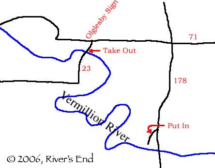
To the putin This is the map to the put-in from Route 39. Basically, you take Tonica Road east until you come to a T-Intersection with 178. At this point you'll hang a left where you'll motor through Lowell, then you will drive across a bridge which crosses the Vermillion, a glance to the left and down will get you a view of the put-in and the entrance rapid. Hang the first left after the bridge, it's just a little dirt road. Ta-da! You're there. |
|
To the takeout (shuttle) Easy way to the take-out from the put-in. Just hang a left out onto 178 and keep going to your first stop sign. This is 71. Just hang a left. Then about a mile down the road you'll hang a left down 23 which is marked by a green sign with an arrow that says Oglesby. About a half mile down the road there is another bridge crossing the Vermillion. This is the take-out. (Just try to be considerate about parking) |
|
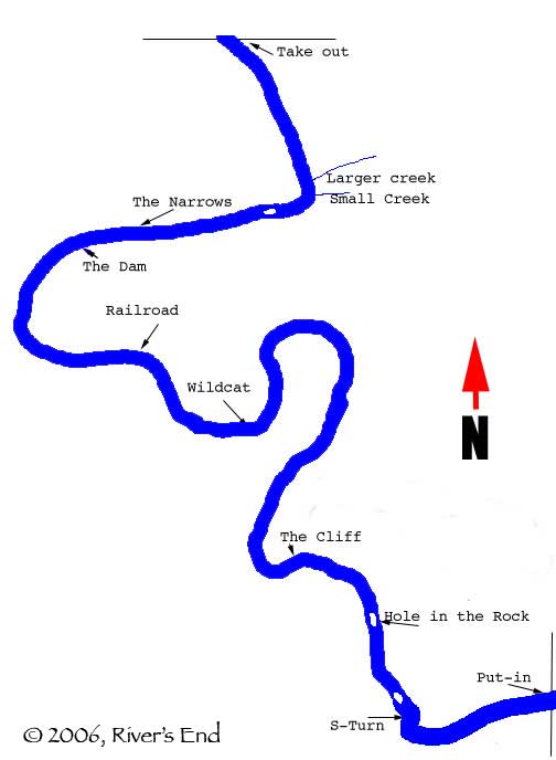
Map of River w/ points of interest This is a map with various points of interest listed. Handy, eh? |