USGS Gauge
The level is from Riverton, 30 miles upstream of the dam breech... so the accuracy is questionable, but it is all we have. This are levels I have confirmed myself. While they will be limited until I get down there more, they will do for now.
Level observations.
RL = River Left, RR = River Right
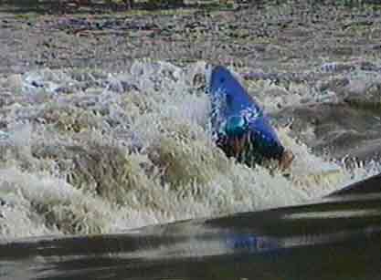
Riverton @ Time on the river Riverton 20 hour delay "Uncle Bill's" scale Description 12 feet 3800 cfs 51 inches Very nice level, breaking wave great for spinning 9.85 feet 2630 CFS
9.96 feet 2680 CFS
32 inches Beautiful level. (picture) River left is a couple of real nice waves for surfing, and in the middle is the schweet hole. Surfing, cartwheels, any moves possible in a hole.
More level translations by John Stefan - a local boater.